|
|
||||
| Region: Southeast | Legislative District: 8 | Length: 0.08 mi. | FY 2025 Urban Arterial Program (UAP) |
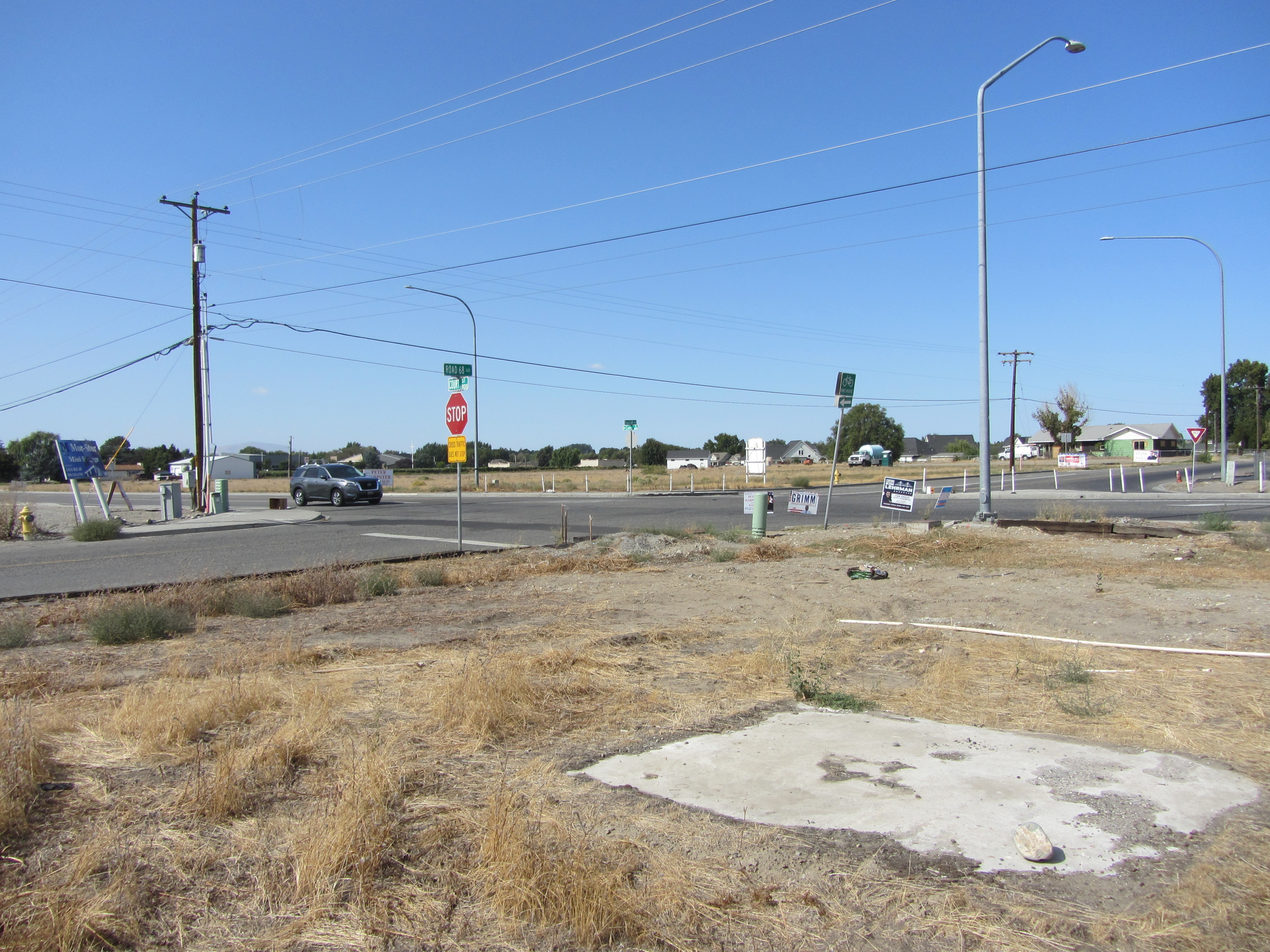 |
Existing ConditionsThe intersection of Court Street and Road 68 has been identified in the Local Road Safety Plan (LRSP) and the Transportation System Masterplan (TSMP) as an area of concern. This intersection experiences high volumes of vehicular traffic: Court Street and Road 68 are classified as Principal Arterials with 9,044 ADT and 7,444 ADT, respectively. Both Court Street and Road 68 connect neighborhoods with commercial areas located east and north of the project location, respectively. Pasco rapid growth over the last decades, has exacerbated congestion and safety concerns at the intersection. Currently the city population is estimated at over 78,000 (2021 data) and designated as a distressed community. Furthermore, the intersection lacks pedestrian and bicycle facilities, limiting alternative modes of transportation. Road 68, a 3 lane roadway aligned N-S, has currently a two-way stop-controlled intersection with Court street. Court Street, a 5 lane roadway, experiences free east/west movement. Currently, traffic must navigate multiple lanes of cross traffic when making southbound and eastbound left-turn movements. 32 crashes have been recorded at this intersection between 2017 and 2022, including serious injury. In the last three years there have been twelve crashes, four of which resulted in injuries and are reported in the crash data section. Covid19 reduced traffic volumes and, therefore crashes. 3-year data provided (2020-2022) reflects this reduction, and may be misleading. |
Project Funding
| TIB Funds | Local Funds | Total Costs | |
|---|---|---|---|
| Design | 0 | 0 | 0 |
| Right of Way | 0 | 0 | 0 |
| Construction | 1,600,000 | 1,678,900 | 3,278,900 |
| Project Totals | $1,600,000 | $1,678,900 | $3,278,900 |
Local Match
| TIB Participation | Local Match | Minimum Local Match |
|---|---|---|
| 48.8% | 51.2% | 20% |
Summary of Improvements
Description of Improvements
A traffic analysis was completed by the City, through its consultant, in 2022. Various intersection treatment alternatives were evaluated, and concluded that a roundabout was the preferred solution to adequately address safety and congestion issues at this intersection. The proposed roudabout was determined to appropriately serve current demand and planned mid to long-term needs. At the time of the study, Road 68 Southbound in the intersection experienced LOS C and D, and were anticipated to degrade into level E within the next year. The proposed improvements would provide for adequate level of service at the intersection for the study horizon (LOS C by 2045). A roundabout was selected over the installation of a traffic signal. When the project is completed, the intersection is expected to enhance both regional connectivity and local access for multiple modes of travel including motor vehicle, pedestrian and bicycle traffic. The project includes utility upgrades to avoid future disruption of proposed surface improvements and adequate lighting for motorized and non-motorized users. Hardscape was incorporated in this project, eliminating needs for permanent irrigation system.