|
|
||||
| Region: Puget Sound | Legislative District: 39 | Length: 0.42 mi. | FY 2024 Urban Arterial Program (UAP) |
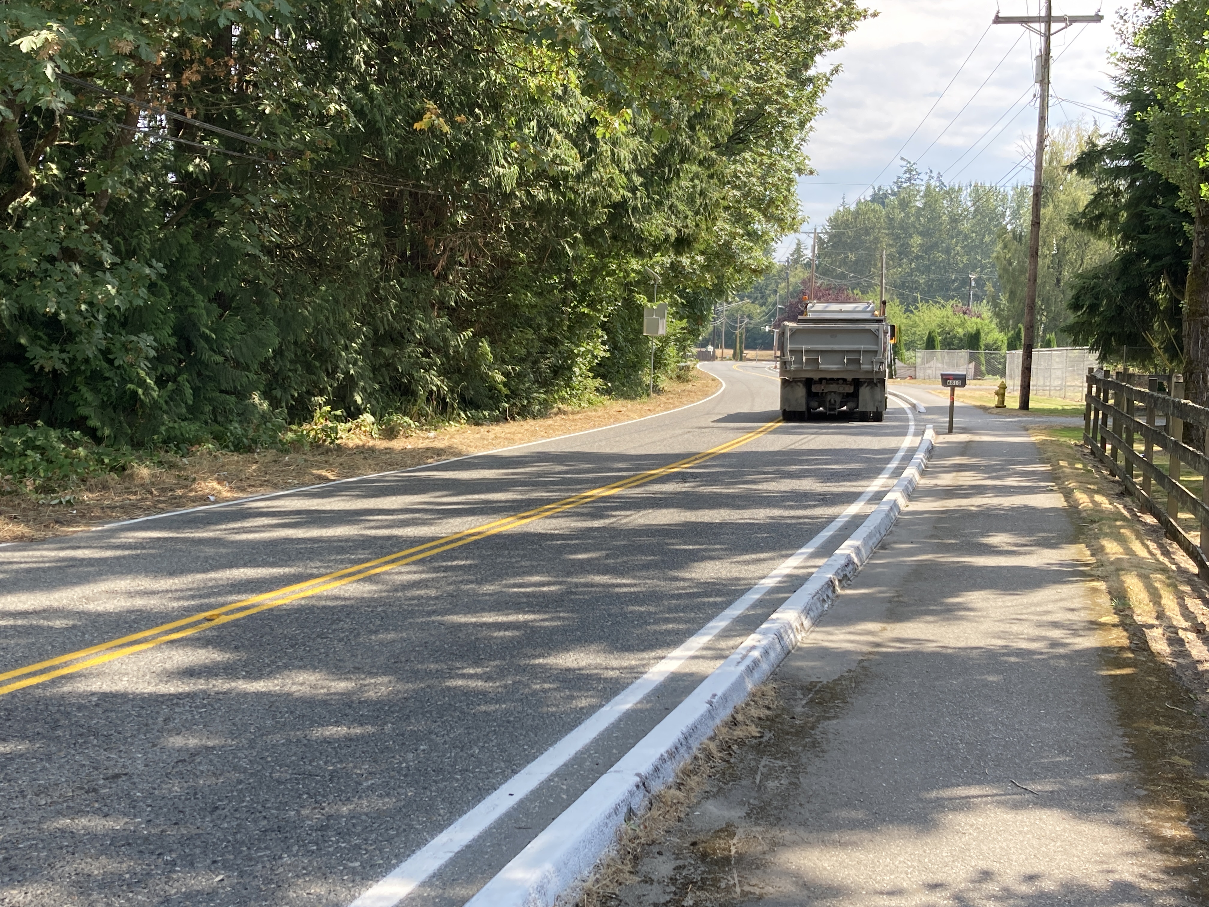 |
Existing Conditions211th Place is a designated Arlington freight/truck route that serves as a connector road joining SR-530 to Arlingtons 67th Ave, a main Arlington arterial connecting two city centers each less than mile away - Old Town Arlington to the north and the Cascade Industrial Center to the south. In addition to being a WSDOT classified T3 freight route carrying over 350,000 tons of freight per year, 211th Place is the primary access way to Arlingtons Northern Bluff residential neighborhood (see Attachment 2).This roadway was the main road into Arlington long before SR-530 or SR-9 were constructed, as such the corridor was not designed to accommodate the large amount of freight traffic it sees today. Not only is this corridor showing its age with failing pavement and lack of pedestrian walkways, the north roadway embankment is sliding and causing settlement in the roadway. One of the problems limiting traffic volumes is the unsafe vehicle access on to SR-530. To improve safety, WSDOT is currently designing a roundabout for the SR-530/211th Place intersection that will be constructed in early 2023. Once this safe access on to SR-530 is provided, the traffic on 211th will increase even more. The community need is for 211th Place to be rehabilitated into a Complete Streets corridor to accommodate current and future traffic, freight, and pedestrian needs. |
Project Funding
| TIB Funds | Local Funds | Total Costs | |
|---|---|---|---|
| Design | 181,143 | 46,083 | 227,226 |
| Right of Way | 75,335 | 19,165 | 94,500 |
| Construction | 2,043,522 | 519,870 | 2,563,392 |
| Project Totals | $2,300,000 | $585,118 | $2,885,118 |
Local Match
| TIB Participation | Local Match | Minimum Local Match |
|---|---|---|
| 79.7% | 20.3% | 20% |
Summary of Improvements
- Improves safety;
- Completes gap;
- Restores structural condition;
- Builds multimodal facilities
Description of Improvements
The ptoject meets communitys need by reconstructing this short, but vital, connector bringing it up to Arlingtons Complete Streets standards. The most vital component will be geotechnical investigation and stabilization of the embankment and road prism. Once geotechnically stabilized, a new roadway can be constructed that drains stormwater runoff away from the embankment and to a properly designed stormwater system. Guardrail will be installed along the embankment along with corridor lighting (pedestrian and street lighting). A 12-ft wide multi-use path will be constructed on the south side of the road along with ADA compliant curb ramps, landscaping and street amenities (artwork, refuse cans, benches, etc.).